
In the world of mapping, people use different types of maps for different purposes (cue Captain Obvious). Depending on your industry, your end users all have very different goals when they are trying to go through location data. Despite that, we’re able to leverage very powerful mapping frameworks and tools to create very different tools to meet those needs, despite having a common ancestry in terms of the code. This is important, because as you start to understand mapping you learn new and creative ways to both build and use these resources.
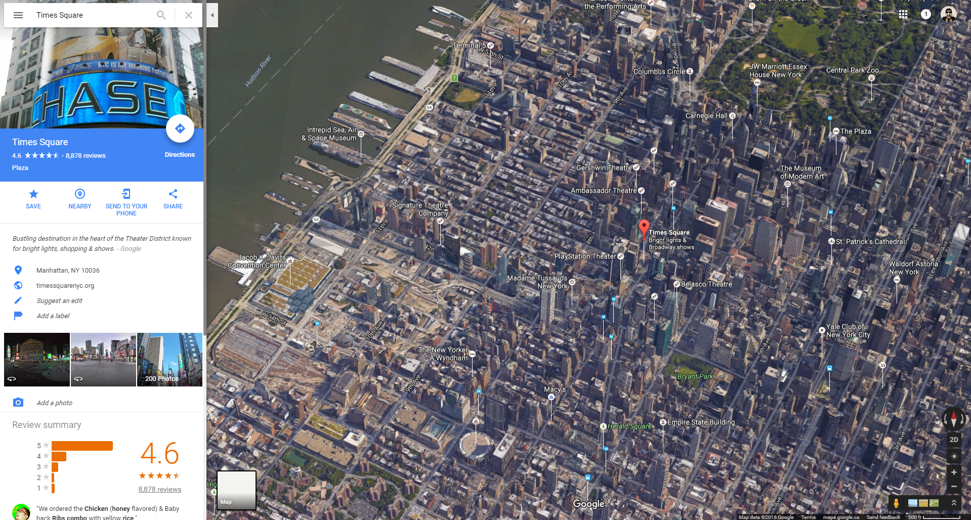 The most common aspect of interactive most people are used to is traditional wayfinding via utilities like Google or Apple Maps. These tools use real world geo-positioning , combined with road and location data to make sure you’re able to find your way from Point A to Point B. In their most basic form, these maps are simple, two-dimensional, colored maps. You can drag and zoom them, search, and get directions. Most services now enhance these systems with satellite imagery data, bird’s eye views, and 3D modeling of structures – but these are still just enhancements built on a very simple premise: Where are you, and where are you going?
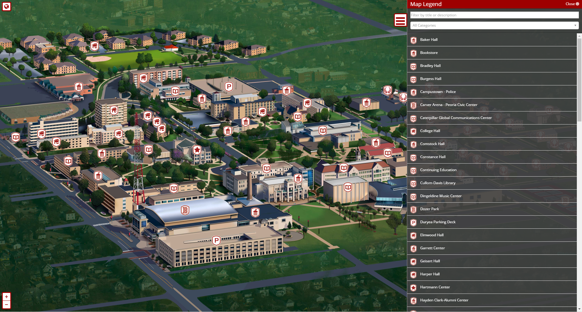 When wayfinding isn’t necessarily the goal, but the location is still important, you find an intersection of tools that offer marketing-oriented virtual experiences of locations. These maps frequently feature illustrated maps of many different styles which may or may not necessarily directly >map exact locations on the globe – which is to say that they represent the place, but they may be artistically skewed to leave out surrounding areas or use views or perspectives that don’t line up to latitude and longitude. Like traditional providers such as Google, these maps will usually include a lot of location data, but the information is tailored by the location being represented, and usually has design that focuses heavily on experiencing the location, not just getting reviews or operating hours for it. These maps will frequently include extra information not normally available somewhere like Google Maps, and blend together a mix of imagery, audio, video, 360, or even VR media to encourage the viewer to come to the location.
 When wayfinding and marketing aren’t the goal, research often is. Mapping data is an extremely rich and deep field to explore, and can relate to anything from energy consumption to weather patterns. These maps can be made interactive to see the changes in crime activity in neighborhoods over time, or the effects of coastal flooding as sea levels rise. Municipalities use these maps for much more mundane activities as well, like tracking sewer access, traffic light status, or simply plotting rummage sales for the weekend. The possibilities of data driven maps are limited only by the availability of data and APIs to combine them with.
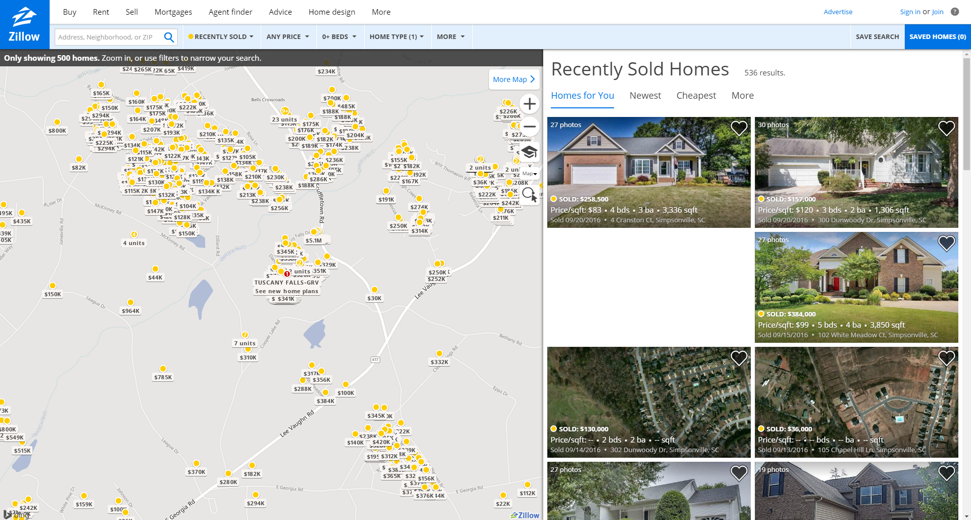 The last usage we want to talk about is planning. Interactive maps make great planning tools, whether you’re looking for bike routes, where to go camping, or to purchase a new home. After all, we live our lives within the confines of latitude and longitude (for now, anyway. Hurry up Elon). So it makes perfect sense to turn to mapping tools when we are looking to coordinate activities or assist in decision-making. These maps are generally very action oriented, and focused on getting you (or your visitor), to do something transactional. As such, they’ll frequently have user accounts attached to them that allow people to save options, information, plans, and so on.
This list is by no means exhaustive, either. For instance, you can view real time weather patterns, study the extent of historical empires, get an idea of where cyber attacks are originating from, explore imaginary worlds, track flight patterns, <a href="https://bramus.github go to the website.io/mercator-puzzle-redux/”>play games, understand the effects of light pollution or nuclear blasts, or track just about anything from sharks, to satellites, to tweets. And that’s barely even scratching the surface of the potential of interactive maps and why they’re important. Whether you are working on planning important travel, or just trying to waste some time and have fun, these simply complex utilities are there to be of service to you.